
 ka
ka
 en
en
 ru
ru


 35118
35118
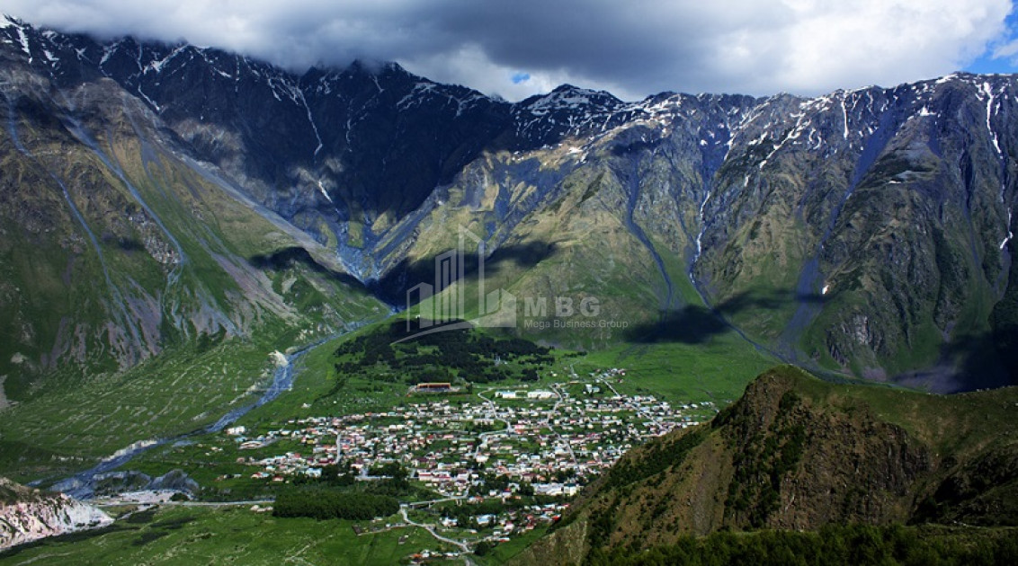
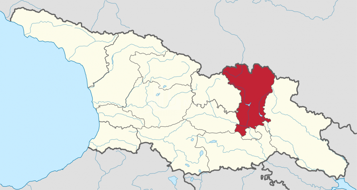
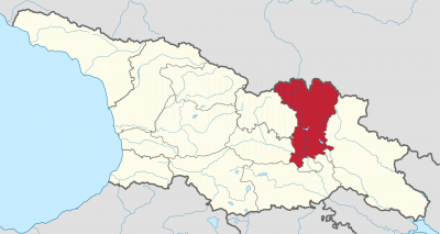
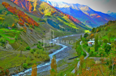
Mtskheta-Mtianeti region - a region in eastern Georgia, includes the territories of the historical-geographical provinces of Shida Kartli, Ertso-Tianeti, Pshavi, Khevsureti, Mtiuleti, Gudamakari, Ksniskhevi. International Area Code: GE-MM.
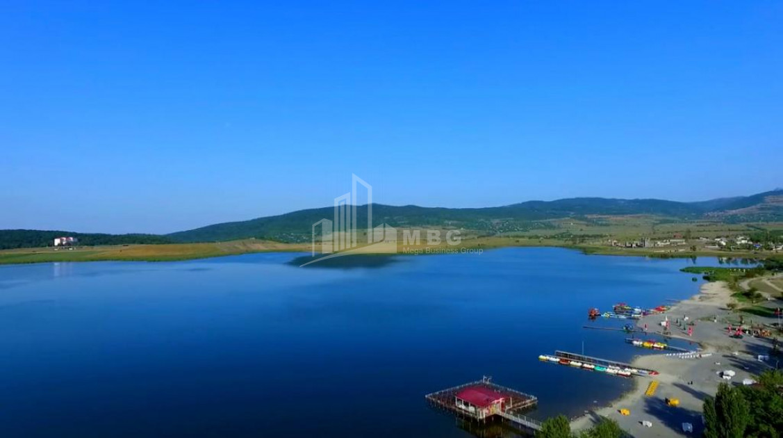
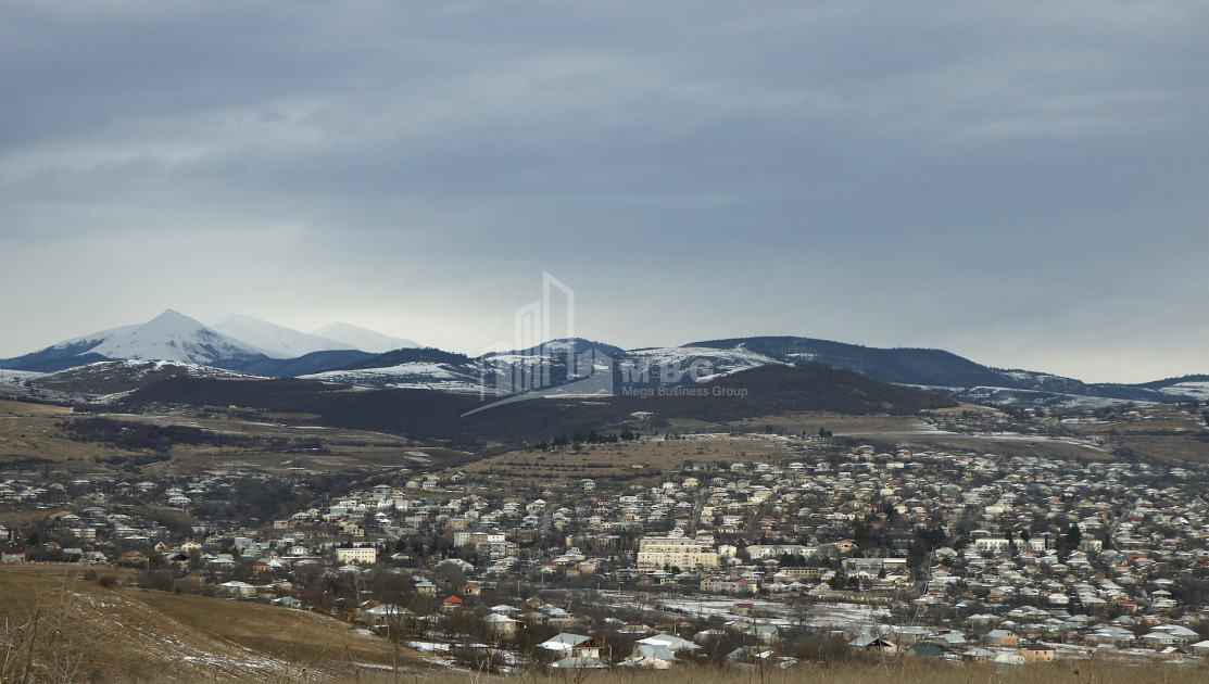
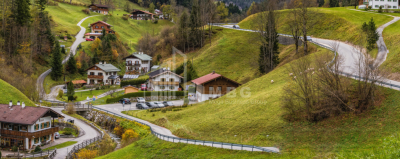
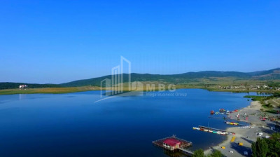
- The area of the region is 6785 sq. Km, the population is 94,573 people, the population density is 13.9 people per 1 sq. Km. The administrative center of the region is the city of Mtskheta. On the side 411
There are settlements, including:
- City - 2: Mtskheta, Dusheti;
- Small town - 5: Zhinvali, Pasanauri, Tianeti, Sioni, Stepantsminda;
- Village - 404.
- Ethnic composition - Georgians, Azerbaijanis, Ossetians, Assyrians, Armenians, Russians.
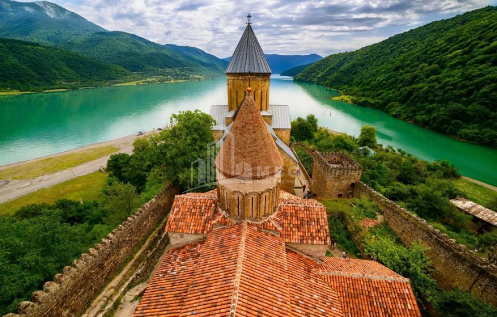
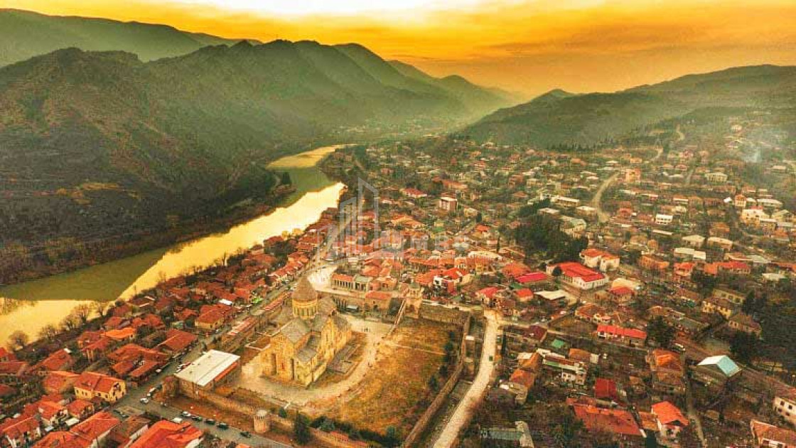
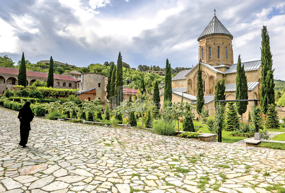
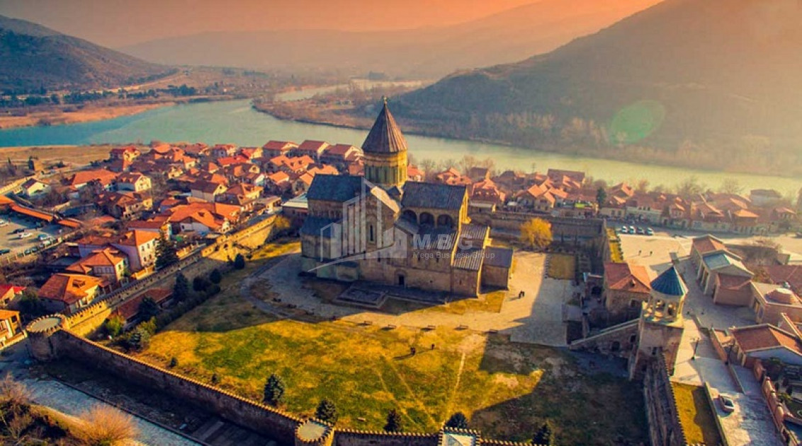
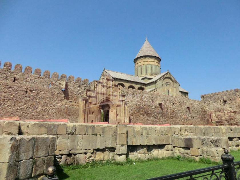
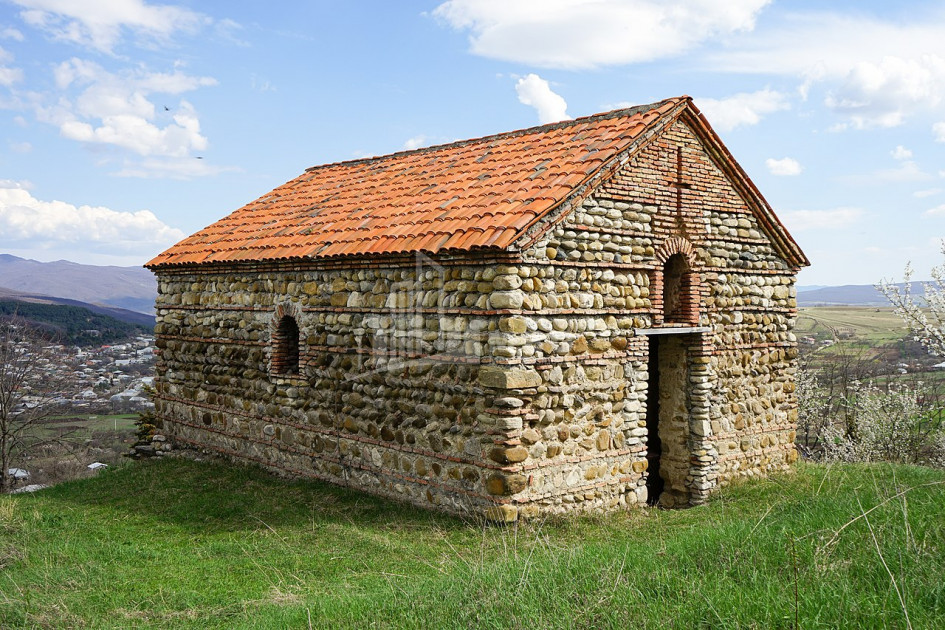
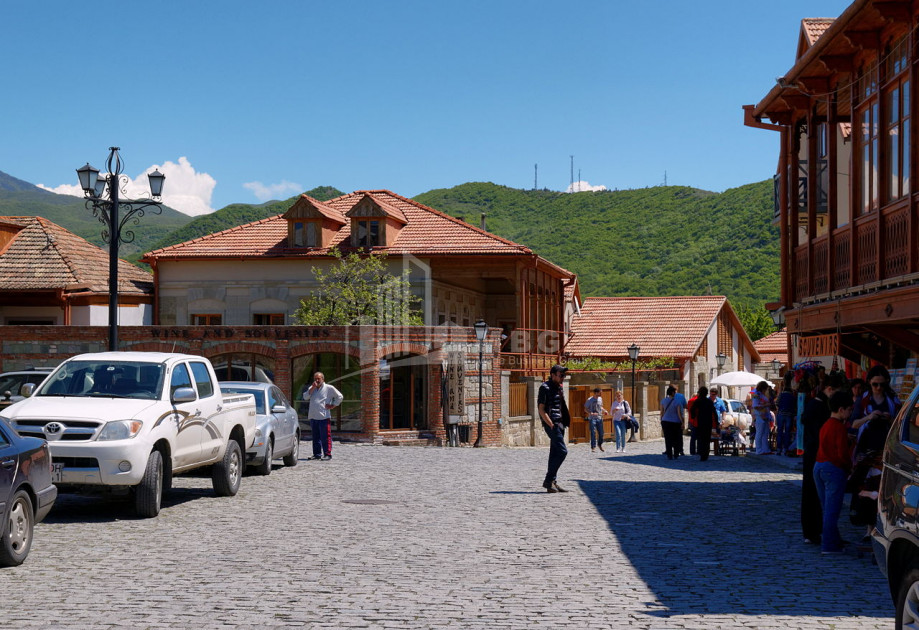
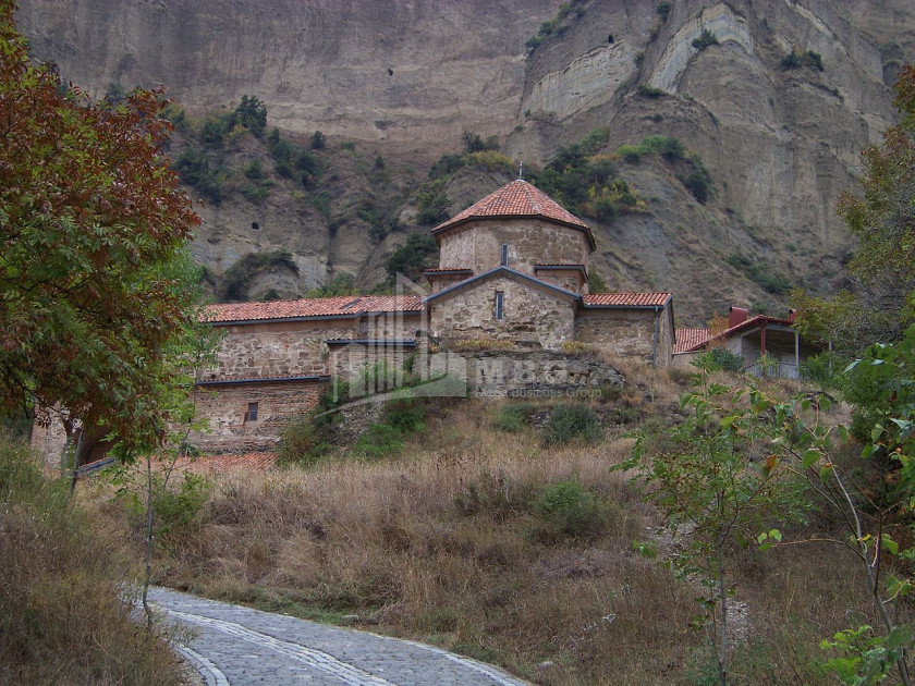
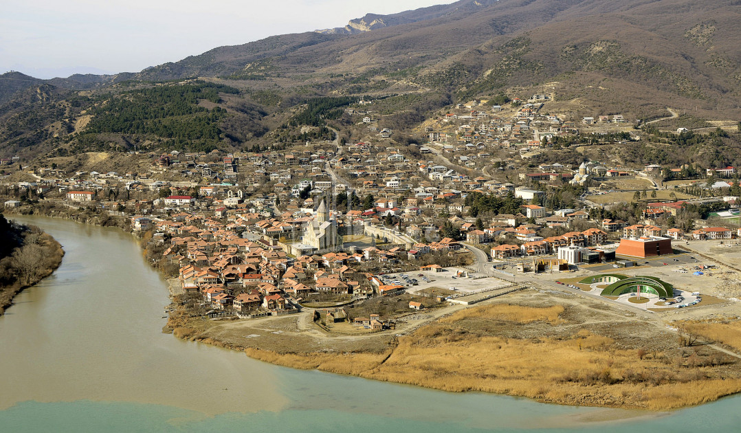
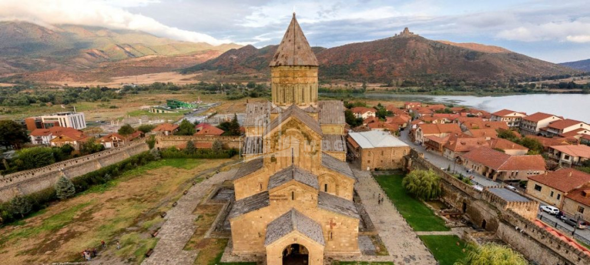
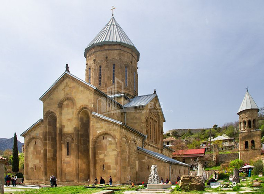
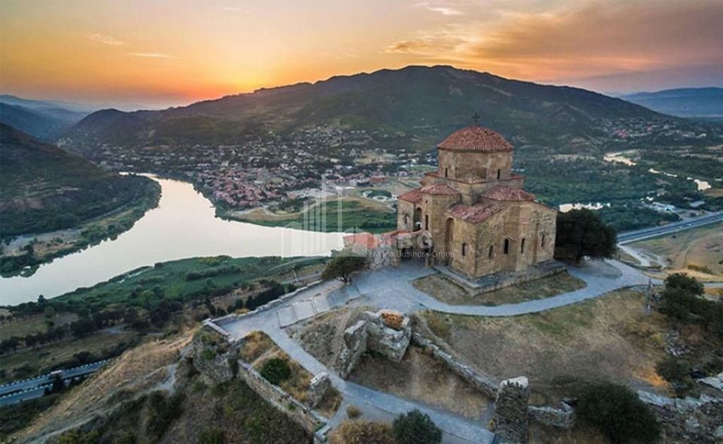
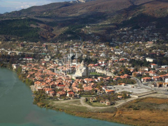
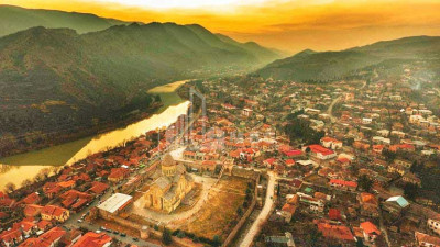
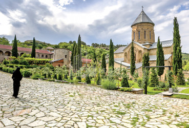
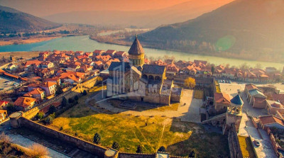
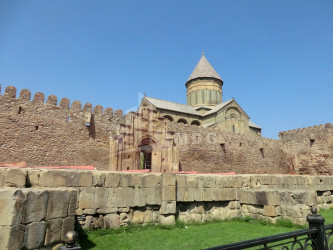
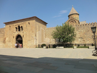
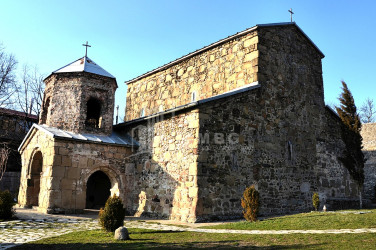
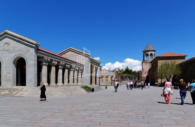
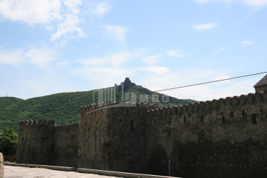
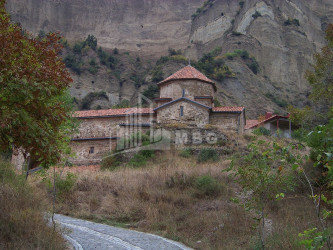
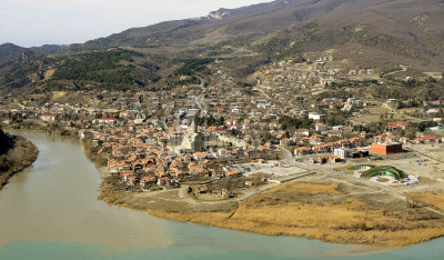
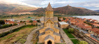
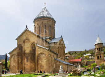
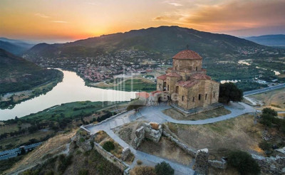
Mtskheta - a city in Georgia, the administrative center of Mtskheta Municipality and Mtskheta-Mtianeti region. The historical monuments of Mtskheta are included in the UNESCO World Cultural Heritage List. Population 7940 people (2014). There is a railway station, food and light industry enterprises, Zemo Avchala HPP. The city has many monuments of culture (universities, theater, museum) and architecture. It is located at the confluence of the Mtkvari and Aragvi rivers, on both the Mtkvari and the right bank of the Aragvi. Railway station on Tbilisi-Samtredia line. 480 m above sea level, 21 km from Tbilisi (by railway). Mtskheta has a moderately humid subtropical climate (average annual temperature 10.8 ° C; January - 1.1 ° C, July - 22.1 ° C). Knows cold winters (absolute minimum - 29 ° C) and hot summers (absolute maximum 39 ° C). Precipitation is 590 mm per year.
economic
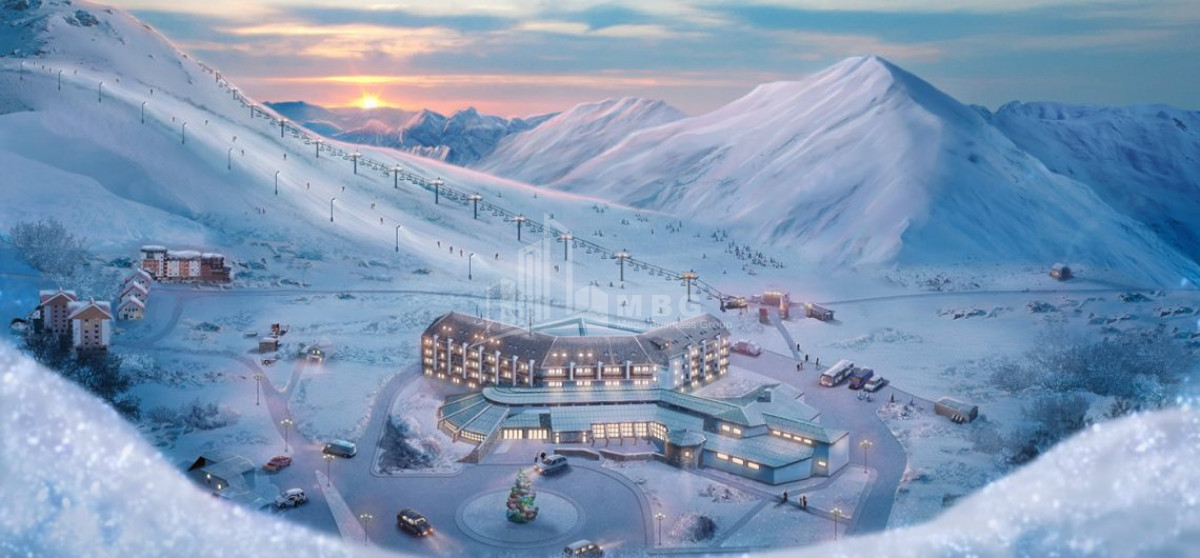
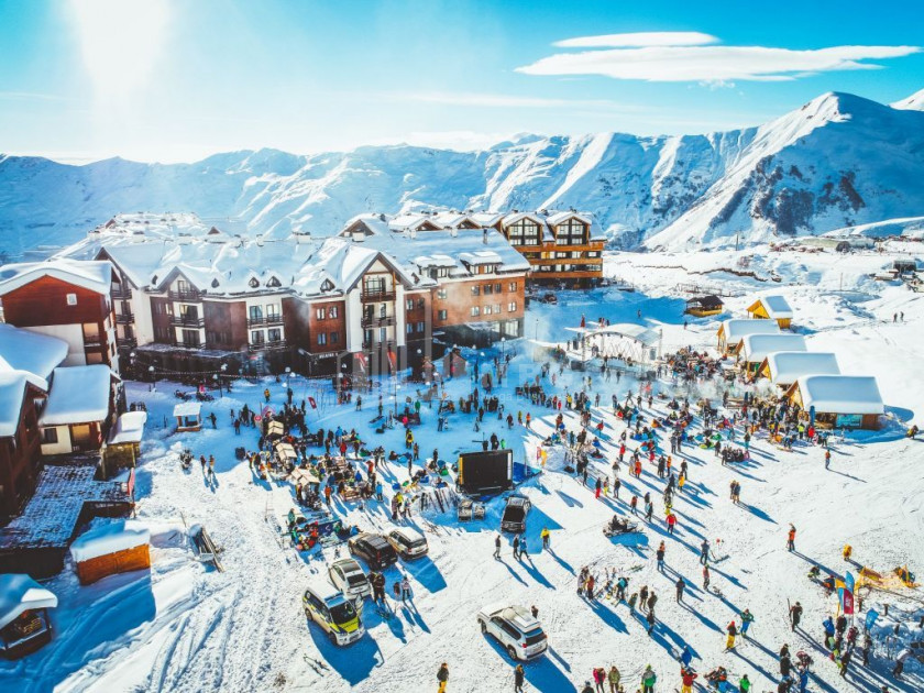
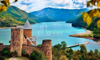
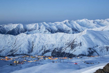
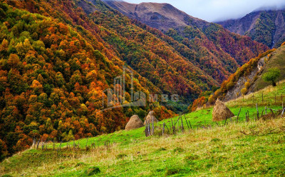
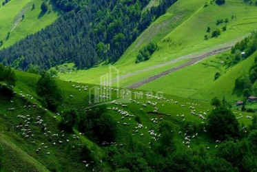
- Mtskheta-Mtianeti is mainly an agricultural region, where there are livestock (Tianeti, Dusheti, Kazbegi) and horticulture-horticulture districts (Mtskheta, partly Dusheti). The Georgian military road passes through this region, it is currently theonly highway connecting Russia and Georgia. Industrial facilities are concentrated in Mtskheta and Dusheti. Gudauri, the main ski resort of the country, is located in the region.
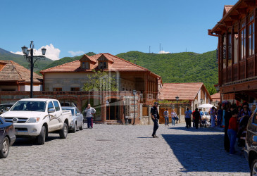
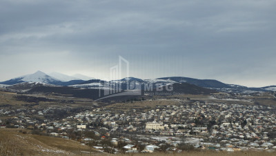
- Dusheti is a city in Georgia, the administrative center of Dusheti Municipality. There are educational and cultural institutions in the city, a theater, a museum of local lore, and the Dusheti Geophysical Observatory. Dusheti is the residence of Tsilkani Diocese. It is located in Dusheti cave, on both banks of the river Dushetiskhevi. Railway station 33 km from Mtskheta, 50 km from Tbilisi, 900 m above sea level. The weather in Dusheti is moderately humid. Knows moderately cold winters and long warm summers. The average annual temperature is 9.7 ° C, the average temperature in January is -1.4 ° C, in July 20.4 ° C. Precipitation is 740 mm per year.
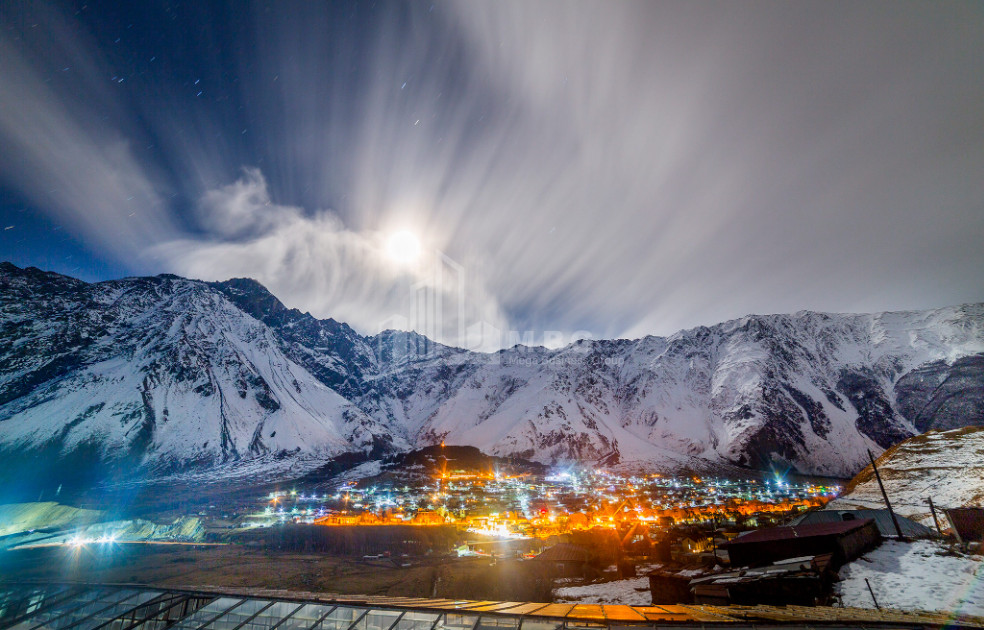
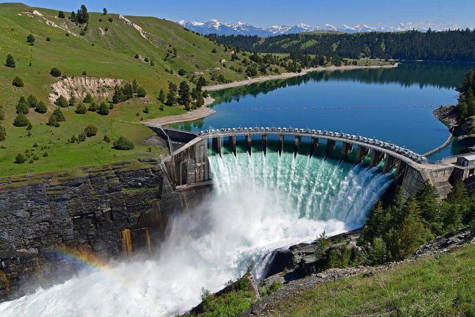
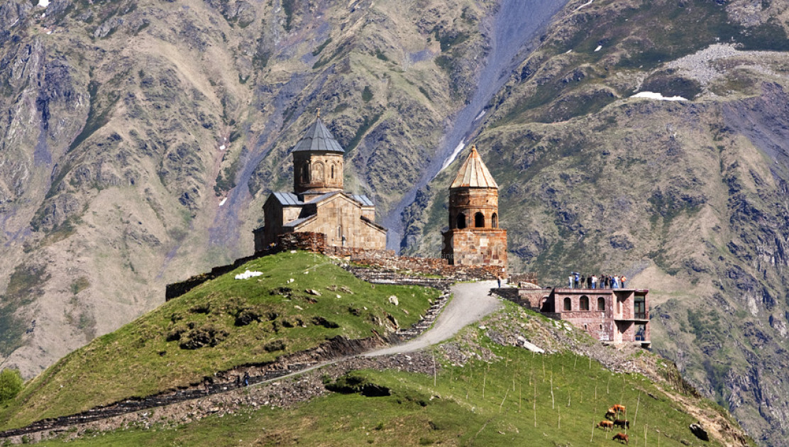
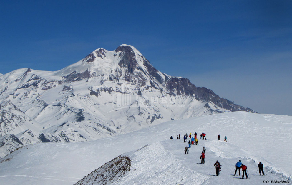
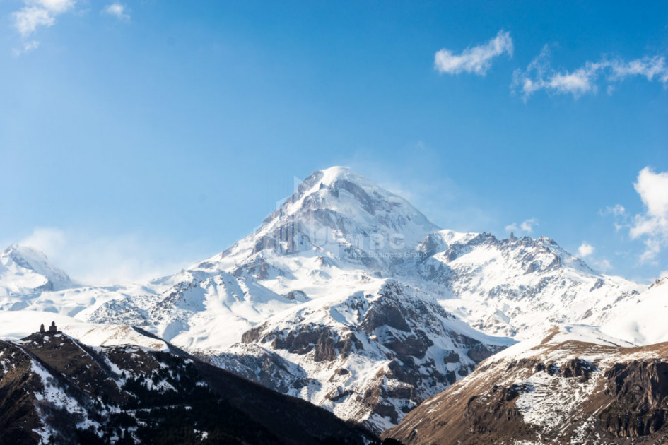
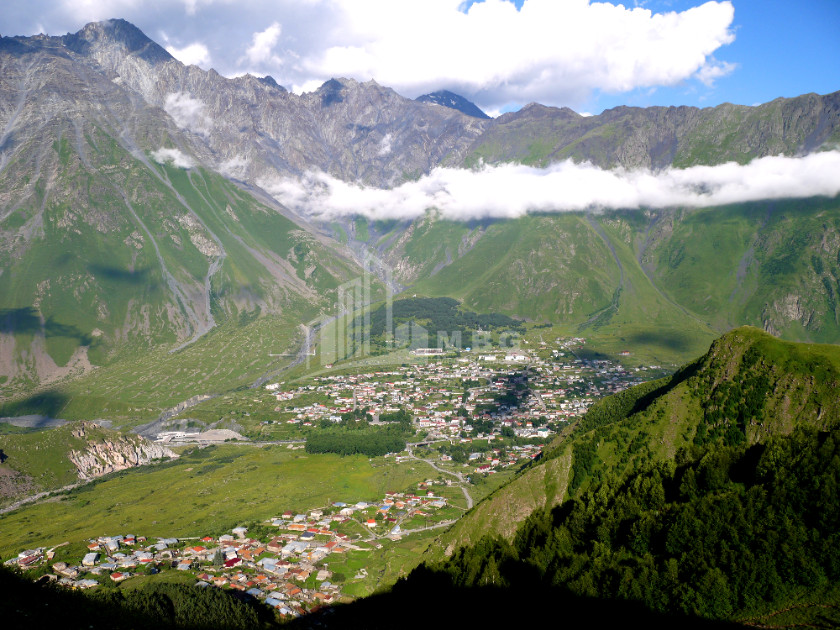
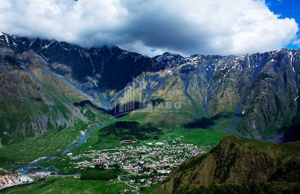
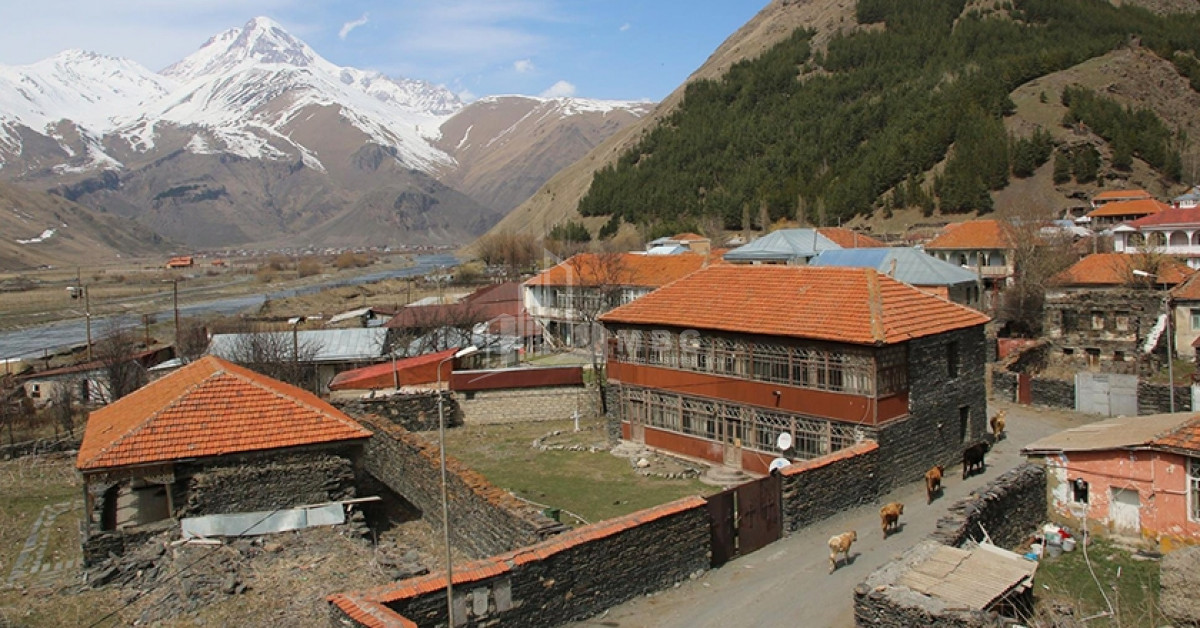
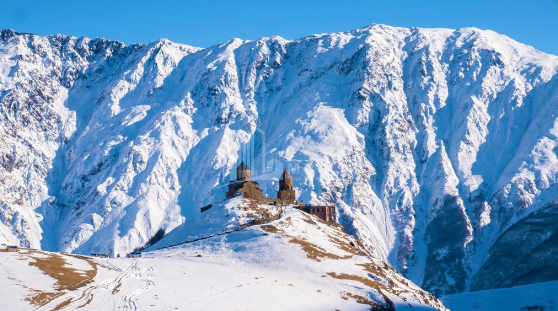
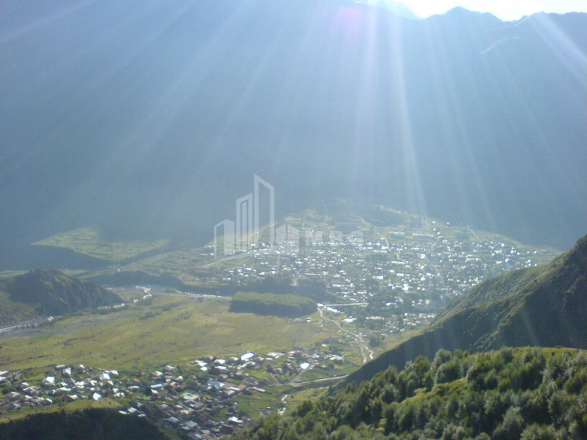
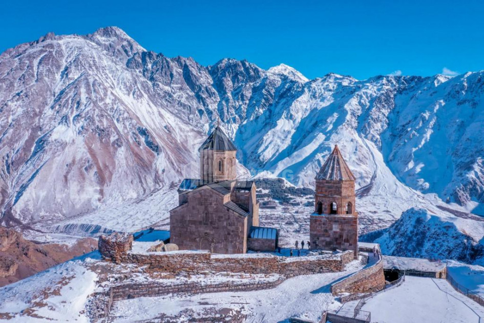
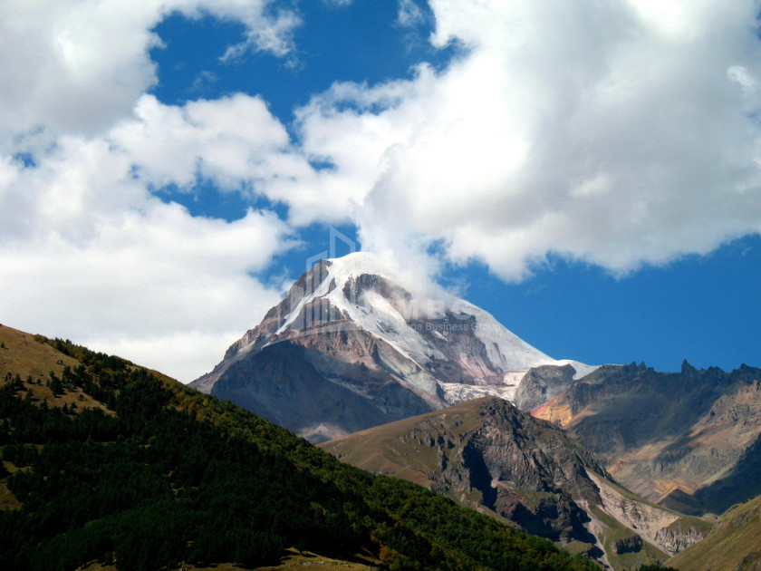
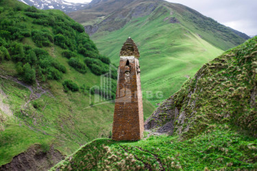
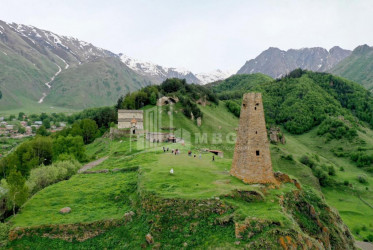
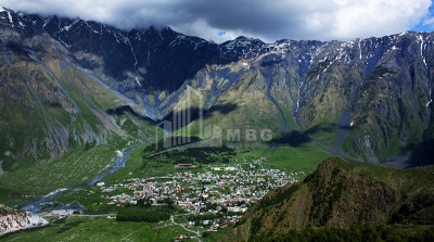
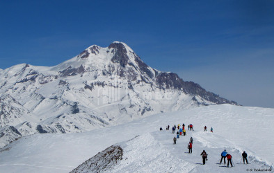
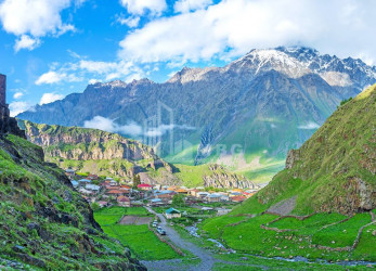
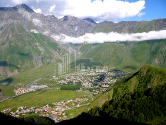
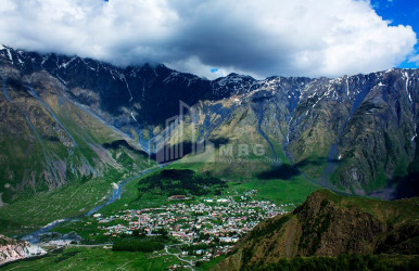
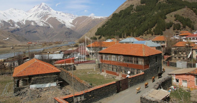
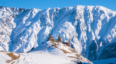
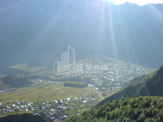
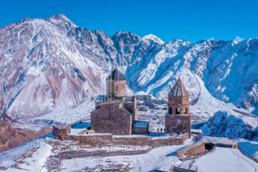
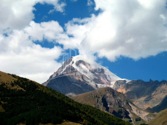
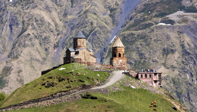
- Kazbegi - is an administrative-territorial unit in eastern Georgia, in the Mtskheta-Mtianeti region. The administrative center is the town of Stepantsminda. Kazbegi municipality mainly includes the historical-geographical part of the gorge. Kazbegi municipality is bordered by Dusheti municipality to the southeast, Akhalgori municipality to the south, Java municipality to the west, and the Russian Federation to the north. The area of the municipality is 1081.7 km2. The territory of the municipality is completely mountainous. Altitude varies from 1700 m to 5000 m above sea level. It is moderately humid in the relatively low zone (within 1700 m). Winters are cold and dry, and summers are cool. The average annual air temperature is 4.9 ° C, and the average annual rainfall is 800 mm. The average air temperature drops to 3.5 ° C in the range of 1800-2000 m above sea level, while the precipitation reaches 1160 mm. Above 3600 m there is a nival zone. The hydrographic network is frequent. The municipality is rich in rivers, lakes, glaciers and mineral springs. The main river is Tergi, the length of which is up to 85 km within the municipality. It originates in the glaciers of the Khokhi ridge. The municipality is rich in lakes. Notable are Lake Kelitsadi, Lake Archevi and more. Glaciers are also widely represented in the municipality. The widest glaciation is characterized by the glacier massif (area about 80 km). There are quite a lot of glaciers running through the glacier. The most important are the Gergeti and Devdarak glaciers.
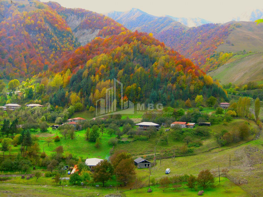
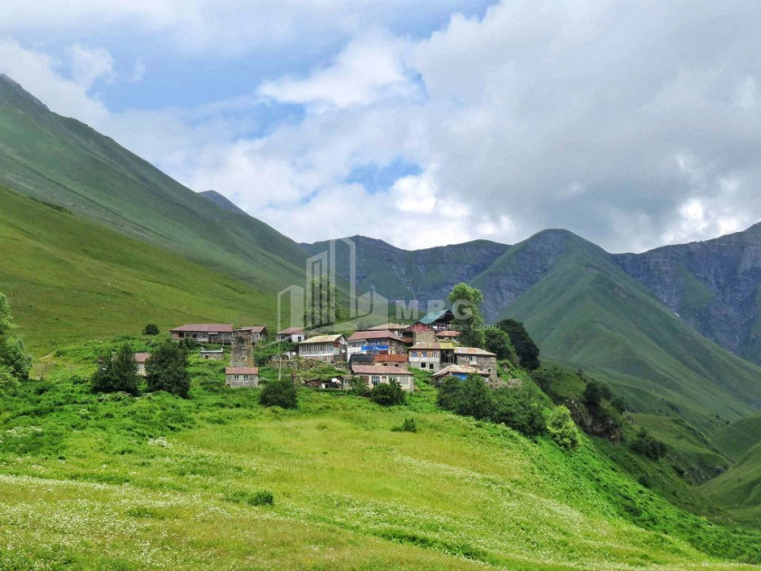
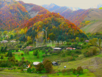
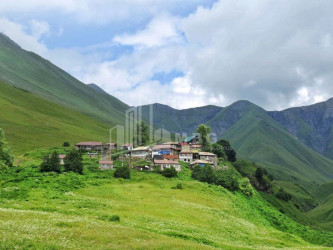
- Gudamakari - the historical-geographical region of Eastern Georgia, mainly considered as one of the communities of Mtiuleti, although it is a separate historical-ethnographic region. Among the historical monuments of Gudamakari region, the sword of the early feudal era is especially important, which is located on the right side of Bakurkhevi, on a mountain ascending like a sword, and the church of the angel of the base of Pirimzi in the village. In Chokhi. The Gudamakari gorge was crossed by one of the branches of the modern Georgian military road, which connected the Aragvi gorge with the gorge.
- Pshavi - is located in Aragvi gorge and includes today's Dusheti municipality. Its area is about 550 km2. Pshavi is bordered on the northeast by the main ridge of the Caucasus, which separates it from Tusheti and Piraketa Khevsureti, on the west by Piraketa Khevsureti, Gudamakari, Khando and Chartali, on the south by Shida Kartli, and on the east by Erzo-Tianeti. Pshavi is divided into two parts: from the head of Pshavi Aragvi to Ortskali is the community of Pshavi, and below Ortskali, in the lower part of Pshavi Aragvi, is the community of Magharoskari. Geographically, Pshavi is located on the border of Kartli-Kakheti and represents the mountains of these two corners, but territorially Pshavi was formerly part of Kakheti province, and with modern administrative-territorial division the whole territory of Pshavi is included in Dusheti municipality of Mtskheta-Mtianeti region. The southern border starts from Sharakhevi and goes through the Ortskhal Pshavi gorge (Shuafkho-Ukanapshavi) to the east and joins the main ridge of the Caucasus. The surface of Pshavi is stretched to the south. It is relatively lower than Tusheti-Khevsureti. Its hypsometric height is 1000-3000 m, so the area of Pshavi is not decorated with white-bearded glaciers, although its nature is more diverse than Khevsureti and Tusheti.
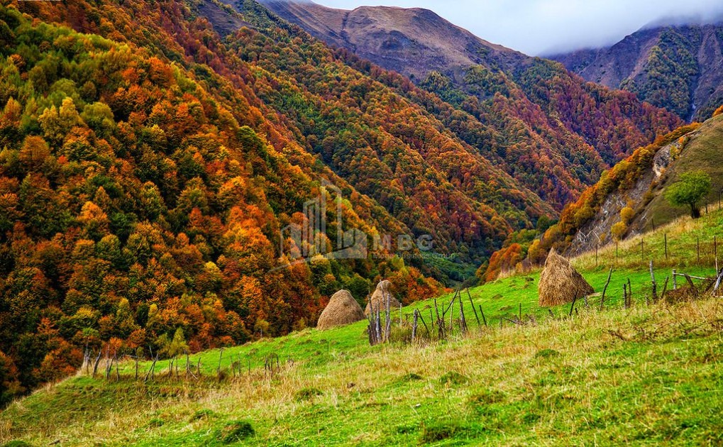
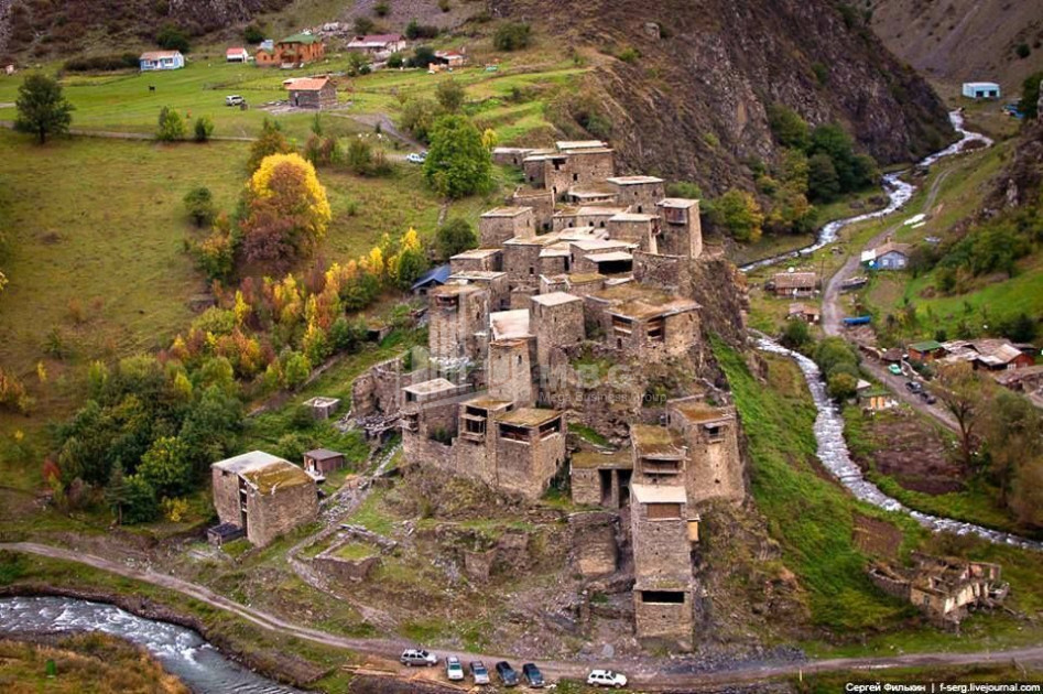
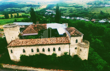
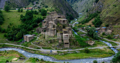
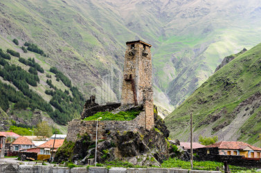
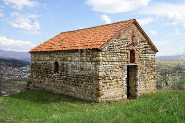
- Khevsureti - historical-geographical part of Georgia. It is located in the mountains of eastern Georgia, on the northern and southern slopes of the Caucasus Mountains, 42 ° 25′-42 ° 27 ეთის north latitude and 44 ° 48′-45 ° 18 აღმოს east latitude. It occupies an area of about 1050 km2. The Caucasus ridge divides Khevsureti into two parts: the north-eastern side, or the opposite Khevsureti, and the south-western side, ie the Piraketa Khevsureti. Pirikita Khevsureti consists of: Mighmakhevi, Shatili and Arkhoti gorges, Piraketi - Aragvi gorges. According to the modern administrative-territorial division, the whole territory of Khevsureti is included in Dusheti municipality of Mtskheta-Mtianeti region and is divided into two topics: Khevsureti (center - Barisakho) and Shatili (center - Shatili).
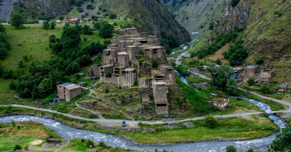
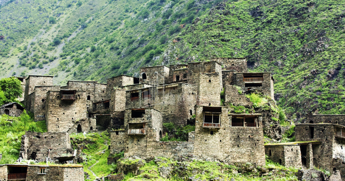
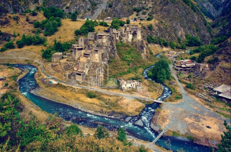
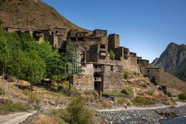
- Shatili - is one of the unique monuments of Georgian construction art. The village perched on a rock was both a dwelling and a fortress, it guarded the northern passages of Georgia for centuries (now restored).
economic
Mtskheta-Mtianeti is mainly the agricultural side, where there are livestock (Tianeti, Dusheti, Kazbegi) and horticulture-horticulture districts (Mtskheta, partly Dusheti). The Georgian military road passes through this region, it is currently the only highway connecting Russia and Georgia. Industrial facilities are concentrated in Mtskheta and Dusheti. Gudauri, the main ski resort of the country, is located in the region.


